Canal walks around Ashton-under-Lyne follow historic linear towpaths along the Ashton Canal and the Huddersfield Narrow Canal. These routes connect central Manchester, Tameside, and West Yorkshire through a network of 18th-century industrial waterways maintained by the Canal & River Trust.
- How Did Industrial History Shape the Huddersfield Narrow and Ashton Canals?
- What Route Does the Ashton Canal Walk Follow from Manchester to Portland Basin?
- What Features Define the Huddersfield Narrow Canal Walk from Ashton to Stalybridge?
- What Key Landmarks and Engineering Structures Can Walkers Observe Along the Routes?
- What Wildlife and Natural Ecosystems Exist Along the Ashton Towpaths?
- How Can Walkers Plan Public Transport, Access, and Safety for Ashton Canal Walks?
- What Are the Community and Ecological Implications of Canal Restoration Around Ashton?
- Frequently Asked Questions
- What are the best starting points for a canal walk around Ashton?
- How long does it take to walk the Ashton Canal from Manchester to Ashton?
- Are the canal towpaths around Ashton suitable for cycling and strollers?
- What amenities and refreshments are available along the Ashton canal routes?
- Is the Huddersfield Narrow Canal towpath open year-round for walking?
The canal network around Ashton-under-Lyne forms a central junction in the northern inland waterway system of the United Kingdom. The primary routes consist of the Ashton Canal, which extends 6.7 miles westward to central Manchester, and the Huddersfield Narrow Canal, which spans 19.75 miles eastward to West Yorkshire. These linear footpaths offer level walking surfaces along historic stone and brick towpaths.
Portland Basin serves as the central focal point where the Ashton Canal, Huddersfield Narrow Canal, and Peak Forest Canal meet. The geographic layout transitions from urban industrial landscapes in East Manchester to rural valleys across the Pennine hills. Walkers access these routes through multiple public entry points located near municipal transit hubs.
The towpaths provide continuous rights of way without motorized traffic, making them accessible for pedestrians, runners, and cyclists. Navigation relies on permanent mileposts, footbridges, and lock numbers marked along the water channel. The waterways remain active for leisure boating, preserving functional maritime engineering features along every section.
How Did Industrial History Shape the Huddersfield Narrow and Ashton Canals?
The Ashton and Huddersfield Narrow Canals were constructed between 1792 and 1811 to transport coal, textiles, and heavy industrial cargo. Engineered by Benjamin Outram and Thomas Telford, these waterways enabled the Industrial Revolution across Greater Manchester and Yorkshire.
Parliament authorized the construction of the Ashton Canal in 1792 to connect regional coalfields with expanding textile mills. Civil engineer Benjamin Outram oversaw the design, completing the main line by 1796 to establish a direct trade route between Manchester and Ashton-under-Lyne. The waterway enabled rapid economic expansion by lowering bulk transport costs for coal, iron, and finished cotton goods.
Work on the Huddersfield Narrow Canal began in 1794 to create a cross-Pennine connection between Lancashire and Yorkshire. The project presented extreme engineering challenges, requiring 74 locks and the construction of Standedge Tunnel. Thomas Telford was retained as a consultant engineer to resolve structural issues, leading to the official opening of the entire route in 1811.
Commercial traffic declined during the early 20th century due to railway competition and motor transport. The Huddersfield Narrow Canal was formally closed in 1944, followed by the abandonment of commercial freight on the Ashton Canal. Restorations led by volunteer organizations and local councils resulted in the reopening of the Ashton Canal in 1974 and the Huddersfield Narrow Canal in 2001.
What Route Does the Ashton Canal Walk Follow from Manchester to Portland Basin?
The Ashton Canal walk covers 6.7 miles from Piccadilly Basin in central Manchester to Portland Basin in Ashton-under-Lyne. The route ascends through 18 locks, passing historic cotton mills, modern sports infrastructure, and residential urban developments.
The western terminus of the route begins at Piccadilly Basin in central Manchester. The towpath proceeds eastward through Ancoats, passing converted 19th-century textile warehouses and modern residential quarters. Walkers navigate past the Ancoats lock flight, where the channel climbs steadily out of the Irwell Valley through engineered brick chambers.
Continuing past Beswick and Clayton, the path passes adjacent to the Sportcity complex and the Etihad Stadium. The route contains 18 working locks that demonstrate 18th-century hydraulic engineering principles. Notable heritage structures along this stretch include Clayton Aniline works relics and historic stone roving bridges designed to prevent horse harness entanglement.
The final section passes through Droylsden before terminating at Portland Basin in Ashton-under-Lyne. The total distance measures 10.8 kilometers, requiring approximately two to three hours of walking time. The entire surface is paved or compacted gravel, offering flat terrain suitable for year-round walking in all weather conditions.
What Features Define the Huddersfield Narrow Canal Walk from Ashton to Stalybridge?
The Huddersfield Narrow Canal walk between Ashton-under-Lyne and Stalybridge covers 2.5 miles of scenic towpath. This section features the first flight of West Coast locks, stone aqueducts, and the restored Portland Basin industrial heritage hub.
The eastern route originates at Portland Basin, where the Ashton Canal meets the Huddersfield Narrow Canal at Lock 1 West. Walkers follow the northern bank along a resurfaced towpath toward historic industrial districts. The waterway runs parallel to the River Tame, crossing watercourses via stone aqueducts engineered during the late 18th century.
This 2.5-mile section contains locks 1W through 7W, which mark the initial western ascent toward the Pennine summit pound. The environment transitions from urban commercial areas into wooded corridors lined with oak, alder, and willow trees. Historic stone mill structures, including former cotton spinning facilities, flank the channel along the Stalybridge boundary.
The route concludes at Stalybridge Basin, a historic transport node featuring preserved canal architecture and public seating areas. Walkers complete this section in roughly one hour. The path features minimal gradient changes outside the immediate lock ramps, providing an accessible route for families, casual walkers, and mobility equipment users.
What Key Landmarks and Engineering Structures Can Walkers Observe Along the Routes?
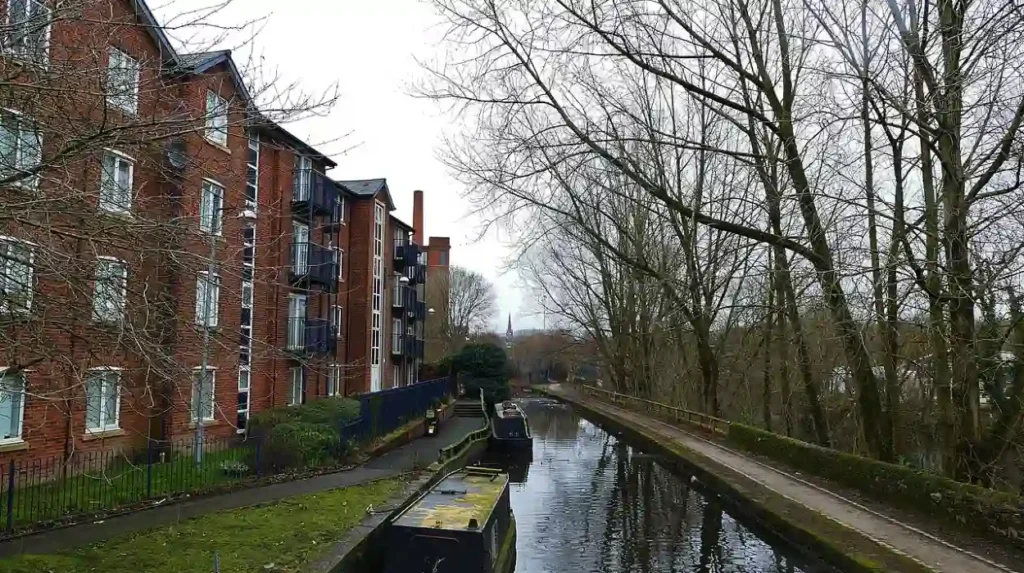
Walkers along the Ashton and Huddersfield Narrow canals can observe major historic engineering structures. Key landmarks include Portland Basin Museum, Standedge Tunnel, the Fairfield Moravian Settlement, and 92 combined working canal locks.
Portland Basin stands as the primary architectural landmark, housing a restored 1834 canal warehouse that now operates as a regional history museum. The building features timber-framed loading bays positioned over a internal boat dock. Nearby, the Fairfield Moravian Settlement, founded in 1785, represents an intact planned religious community situated adjacent to the Ashton Canal towpath.
The canal network features 92 total locks, comprising 18 locks on the Ashton Canal and 74 locks on the Huddersfield Narrow Canal. Standedge Tunnel, located further east along the Huddersfield Narrow route, is the longest, deepest, and highest canal tunnel in Great Britain, measuring 3.25 miles in length.
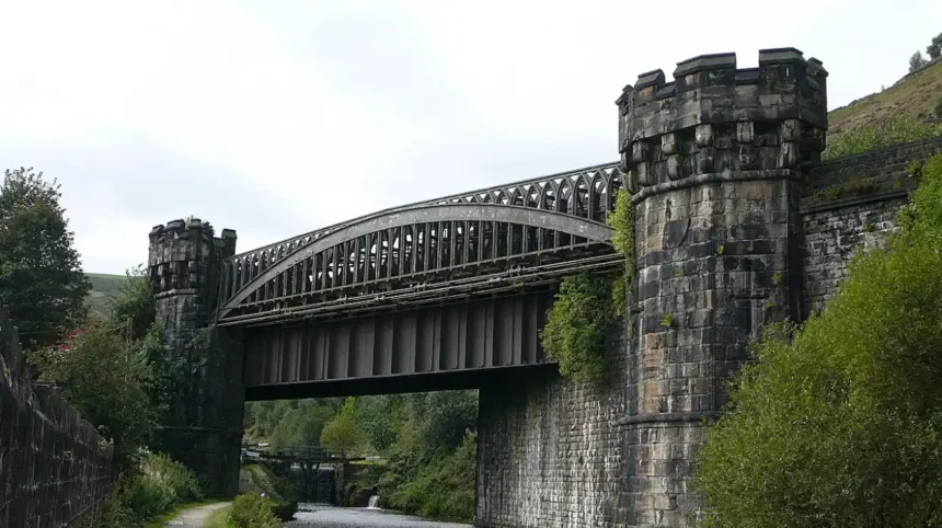
Roving bridges, also known as snake bridges, are positioned along both canal routes. These cast-iron and sandstone bridges were constructed with curved ramps to allow draft horses to cross the canal without detaching their towlines. Cast-iron mileposts set into the stone towpaths mark historical distances to major commercial centers.
What Wildlife and Natural Ecosystems Exist Along the Ashton Towpaths?
The towpaths and water channels around Ashton support diverse freshwater and terrestrial ecosystems. Common wildlife includes aquatic birds, freshwater fish species, bats, dragonflies, and riparian vegetation along protected green corridors.
The canal water column provides habitat for several coarse fish species, including roach, bream, perch, pike, and carp. Freshwater vegetation, such as yellow water-lily and broad-leaved pondweed, oxygenates the water and offers nursery grounds for aquatic invertebrates. Benthic organisms support stable populations of native waterfowl throughout the urban and sub-urban sections.
Bird species frequently observed along the towpaths include mallards, moorhens, coots, mute swans, and grey herons. The kingfisher inhabits quieter stretches of the Huddersfield Narrow Canal between Ashton and Stalybridge, nesting in riverbanks adjacent to the waterway. Native trees including silver birch, sycamore, grey willow, and hawthorn line the unpaved banks.
Linear towpath corridors function as ecological bridges, allowing terrestrial species to navigate between isolated urban parks and rural countryside. Pipistrelle bats forage along the water channel during summer evenings, using the tree canopy for navigation. Odonata species, including the blue-tailed damselfly and brown hawker dragonfly, breed in shallow canal margins during warm months.
How Can Walkers Plan Public Transport, Access, and Safety for Ashton Canal Walks?
Walkers access canal routes around Ashton via the Metrolink tram network, Northern Rail train services, and local bus routes. Safety considerations include wearing non-slip footwear, observing water safety signs, and planning daylight journeys.
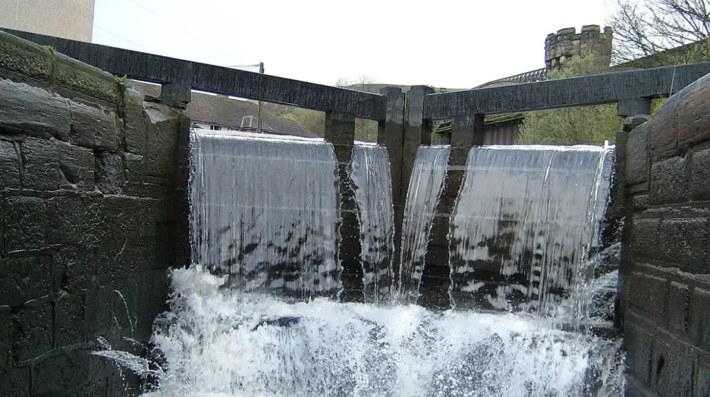
Public transportation provides direct access to multiple points along both canal routes. The Manchester Metrolink Ashton Line runs parallel to the Ashton Canal, with stations at Ashton-under-Lyne, Ashton West, Droylsden, and Audenshaw. Northern Rail operates passenger train services to Ashton-under-Lyne station and Stalybridge station, allowing walkers to complete one-way linear routes and return via public rail.
Towpath conditions vary from smooth asphalt near urban centers to compacted earth, crushed stone, and exposed cobblestones in rural sections. Walkers require sturdy, waterproof footwear with slip-resistant soles, particularly during autumn and winter when wet leaves and mud accumulate. Water levels remain constant, but edge stones can become slick.
Safety protocols require pedestrians to give way to cyclists and working canal boat crews near lock gates. Towpaths lack continuous artificial lighting outside city center zones, making daytime walking preferable. Lifebuoys and emergency throw-line stations are installed at regular intervals near locks and deep basin areas.
What Are the Community and Ecological Implications of Canal Restoration Around Ashton?
Canal restoration projects around Ashton have created sustainable urban green space, protected industrial heritage, and improved climate resilience through urban flood mitigation and non-motorized transport infrastructure.
The physical restoration of the Ashton and Huddersfield Narrow canals transformed derelict industrial ditches into functional public parks. Environmental remediation removed thousands of tons of silt, industrial waste, and invasive vegetation from the channels. This work restored water circulation, restored aquatic biodiversity, and reduced localized flood risks in Tameside.
From an urban planning perspective, towpath improvements provide dedicated active travel infrastructure for daily commuters. By converting towpaths into multi-use paths, local councils reduce private vehicular trips and associated carbon emissions across Greater Manchester. The linear green spaces also mitigate the urban heat island effect across densely built suburban districts.
Community groups, supported by the Canal & River Trust, conduct regular maintenance, native planting, and wildlife monitoring along the water paths. These initiatives protect grade II listed civil engineering structures while maintaining free public access to nature. The ongoing preservation of these waterways ensures long-term ecological stability and cultural resource protection for future generations.
Frequently Asked Questions
What are the best starting points for a canal walk around Ashton?
Portland Basin is the primary starting point for canal walks in Ashton-under-Lyne. It provides direct access to the Ashton Canal toward Manchester and the Huddersfield Narrow Canal toward West Yorkshire. Visitors can also start at Ashton Metrolink station or Stalybridge station for direct towpath access.
How long does it take to walk the Ashton Canal from Manchester to Ashton?
The 6.7-mile route from Piccadilly Basin to Portland Basin takes between two and three hours to complete at a moderate pace. The terrain is flat along paved and gravel paths, making it accessible for walkers of all fitness levels. Public transit options run parallel to the canal for shorter trips.
Are the canal towpaths around Ashton suitable for cycling and strollers?
Yes, the towpaths along the Ashton Canal and the Huddersfield Narrow Canal section to Stalybridge are paved or surfaced with smooth, compacted stone. These paths accommodate bicycles, pushchairs, and mobility scooters. Walkers should remain aware of narrow sections under historic stone bridges and yield to oncoming boaters at lock gates.
What amenities and refreshments are available along the Ashton canal routes?
Refreshments are available at the Portland Basin Museum cafe and nearby town centers in Ashton-under-Lyne, Droylsden, and Stalybridge. Public houses and local cafes operate near major lock flights and canal basins. Restrooms and parking spaces are accessible at municipal transport hubs and public sites along the route.
Is the Huddersfield Narrow Canal towpath open year-round for walking?
The towpath remains open year-round for public pedestrian use under Canal & River Trust management. Surfaces can become slippery or muddy during winter, requiring sturdy footwear. Daylight hours are recommended for walking because towpaths outside urban town centers lack artificial overhead lighting.