Manchester is one of England’s most significant cities, known for its industrial heritage, sporting achievements, cultural diversity, and continuous urban development. Within the city are several historic neighbourhoods that have shaped Manchester’s growth over the centuries. Garratt Manchester is one such area with strong historical roots and an important role in the wider urban landscape of South Manchester. Its location near established communities, transport routes, and regeneration projects makes it an interesting subject for residents, visitors, historians, and property buyers alike. Understanding Garratt Manchester provides valuable insight into the city’s development, changing communities, and future opportunities.
What is Garratt Manchester?
Garratt Manchester is a historic locality in South Manchester that forms part of the city’s wider urban area. It has evolved from an older settlement into a modern residential community while retaining connections to Manchester’s industrial and social history.
The name Garratt refers to an area situated close to Ardwick, Longsight, Rusholme, and Levenshulme. Historically, it formed part of Manchester’s expanding southern districts during the nineteenth century when rapid industrialisation transformed farmland into housing, factories, workshops, and transport infrastructure.
Today, Garratt is primarily recognised through local roads, community facilities, educational institutions, residential neighbourhoods, and regeneration projects. Although it is not officially defined as a separate administrative district, the name continues to appear in historical records, local planning documents, and community references.
The area reflects Manchester’s wider pattern of Victorian expansion, post-war redevelopment, and twenty-first-century investment. Modern housing developments now stand alongside older terraces, public green spaces, schools, and healthcare facilities.
Its strategic position provides easy access to Manchester city centre while remaining closely connected to neighbouring communities that together form one of the city’s most diverse urban regions.
Where is Garratt Manchester located?
Garratt Manchester lies in the southern part of Manchester between several established neighbourhoods and major transport corridors, providing convenient access to the city centre, employment districts, educational institutions, and regional transport networks.
The locality sits approximately three miles south of Manchester city centre. It borders or lies close to Ardwick, Longsight, Rusholme, Levenshulme, Belle Vue, and Gorton. These neighbouring districts create a continuous urban landscape with residential streets, local businesses, schools, healthcare centres, and recreational facilities.
One of the area’s defining characteristics is its excellent transport connectivity. Major roads including Hyde Road, Stockport Road, and the A57 corridor provide direct routes into central Manchester and surrounding boroughs.
Public transport also plays an important role. Several bus services connect Garratt with Manchester Piccadilly, universities, hospitals, shopping centres, and employment zones. Nearby railway stations improve regional accessibility across Greater Manchester and beyond.
Manchester Airport can also be reached within a relatively short journey, making the location attractive for commuters and frequent travellers.
How did Garratt Manchester develop historically?
Garratt Manchester developed rapidly during the Industrial Revolution when Manchester expanded beyond its medieval core, creating new residential districts that supported factories, engineering industries, textile production, and growing commercial activity.
Before industrialisation, much of the surrounding land consisted of agricultural fields and scattered rural settlements. During the late eighteenth and nineteenth centuries, Manchester became one of the world’s leading textile manufacturing centres. Population growth created an enormous demand for housing close to workplaces.
Developers constructed rows of Victorian terraced houses that became characteristic of South Manchester. Railways, canals, roads, warehouses, engineering works, and supporting industries transformed the landscape within only a few decades.
During the twentieth century, the area experienced significant changes. Some older housing was demolished through slum clearance programmes, while new council housing and improved public services replaced ageing infrastructure.
Recent decades have focused on regeneration, environmental improvements, education, healthcare investment, and community development. These changes reflect Manchester’s wider transformation from an industrial city into a diversified economy centred on education, healthcare, technology, finance, culture, and professional services.
What makes Garratt Manchester an important residential area?
Garratt Manchester offers established housing, strong transport links, nearby employment opportunities, educational facilities, healthcare services, and access to Manchester city centre, making it an attractive residential location for a wide variety of households.
Housing across the area includes traditional Victorian terraces, semi-detached homes, modern apartment developments, and newly constructed residential schemes. This mixture reflects more than a century of continuous urban growth.
The proximity to Manchester’s universities, hospitals, commercial districts, and business parks supports demand from students, healthcare professionals, young families, and working professionals.
Residents benefit from supermarkets, independent retailers, pharmacies, GP surgeries, libraries, leisure facilities, community centres, and places of worship located throughout neighbouring districts.
Green spaces also contribute to local quality of life. Parks and recreational grounds provide opportunities for walking, children’s play, organised sports, and community events throughout the year.
Ongoing regeneration continues to improve public infrastructure, environmental quality, and neighbourhood appearance while supporting sustainable long-term development across South Manchester.
How is transport connected to Garratt Manchester?
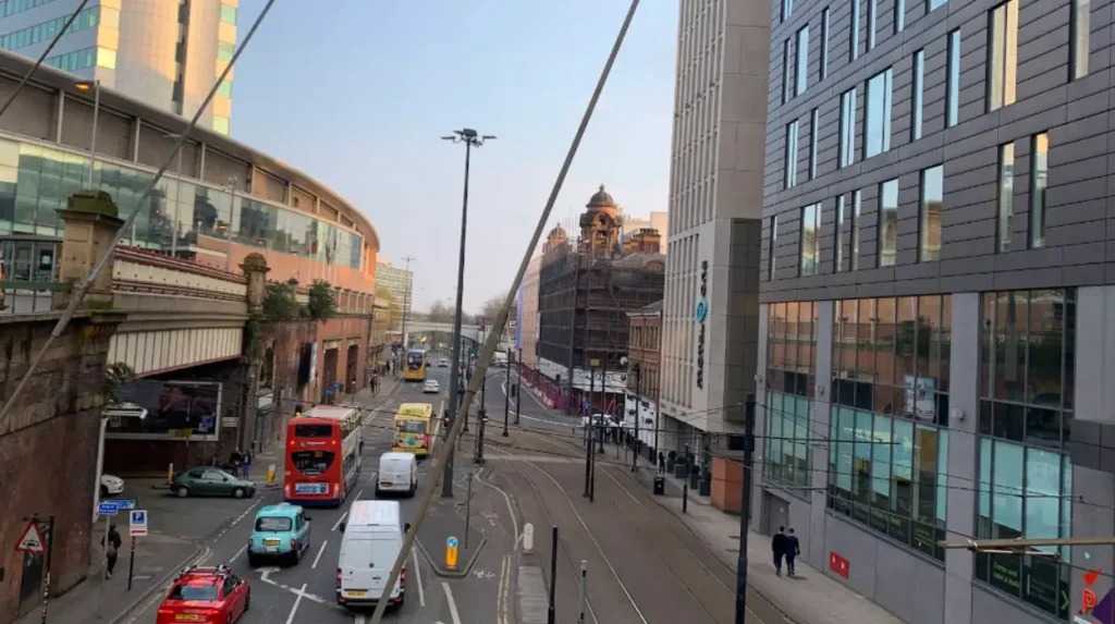
Garratt Manchester benefits from comprehensive transport infrastructure that connects residents with Manchester city centre, neighbouring districts, educational institutions, healthcare facilities, employment centres, and the wider Greater Manchester region. Road transport remains one of the area’s greatest strengths. Hyde Road, Stockport Road, Princess Parkway, and other connecting routes provide efficient travel throughout Greater Manchester.
Frequent bus services operate throughout the day, linking residential neighbourhoods with central Manchester, Piccadilly, Oxford Road, universities, hospitals, shopping destinations, and railway stations. Rail services available from nearby stations allow passengers to travel efficiently across Greater Manchester, the North West, London, Birmingham, Leeds, Liverpool, and other major cities.
Cycling infrastructure continues to improve through Manchester’s wider active travel investment programme, encouraging sustainable transport and healthier commuting options. Walking routes also connect residential streets with schools, healthcare centres, parks, retail areas, and public transport facilities, supporting accessible local mobility for all age groups.
Garratt Manchester represents an important part of South Manchester’s urban and historical landscape. From its origins during the Industrial Revolution to its role as a modern residential community, the area reflects Manchester’s continuous growth and regeneration. Its location close to the city centre, strong transport connections, diverse housing, and access to schools, healthcare, parks, and employment make it a practical place to live and explore. Ongoing investment in infrastructure and neighbourhood improvements continues to strengthen the area’s appeal while preserving its connection to Manchester’s rich industrial heritage. Whether you are researching local history, considering a move, or simply learning more about Manchester’s communities, Garratt Manchester remains a notable and evolving part of the city.
Frequently Asked Questions
Is Garratt Manchester an official district of Manchester?
Garratt is primarily recognised as a historic locality within South Manchester rather than a separate modern administrative district. The name continues to appear in historical references, planning documents, and community discussions because of its long-standing connection to the city’s development.
What areas are close to Garratt Manchester?
Garratt is located near several well-known Manchester neighbourhoods, including Ardwick, Longsight, Rusholme, Levenshulme, Gorton, and Belle Vue. These neighbouring communities share transport links, local services, schools, healthcare facilities, and shopping areas.
Is Garratt Manchester well connected by public transport?
Yes. Garratt benefits from frequent bus services, nearby railway stations, and major road connections that provide convenient access to Manchester city centre, universities, hospitals, employment hubs, and other parts of Greater Manchester.
What types of homes are available in Garratt Manchester?
The area includes a mix of Victorian terraced houses, semi-detached homes, modern apartments, and newer residential developments. This variety attracts families, professionals, students, and first-time buyers seeking housing close to central Manchester.
Why is Garratt Manchester historically significant?
Garratt played a role in Manchester’s expansion during the Industrial Revolution, when the city experienced rapid population growth and industrial development. The area evolved from agricultural land into an established urban neighbourhood that continues to contribute to Manchester’s residential and community landscape.