The Manchester Hills refer to the elevated upland regions, moorlands, and ridge systems surrounding the Greater Manchester conurbation. These geological landforms comprise parts of the West Pennine Moors, the South Pennines, and the Peak District, defining the north and east borders.
- Where are the Manchester Hills located geographically?
- What is the geological history of the Manchester Hills?
- What are the highest peaks in the Manchester Hills?
- How did the Manchester Hills influence the Industrial Revolution?
- What wildlife and habitats exist in the Manchester Hills?
- What outdoor recreational activities are available in the Manchester Hills?
- How do you reach the Manchester Hills using public transport?
- Frequently Asked Questions
The Manchester Hills represent a prominent physical perimeter surrounding the low-lying plain of the Cheshire Basin and the Mersey Valley. Geological uplands frame the urban center across northern and eastern boundaries. The primary upland formations include the West Pennine Moors near Bolton and Bury, the South Pennines stretching past Rochdale and Oldham, and the Dark Peak region along Tameside and Stockport. These landforms feature carboniferous gritstone, shale beds, and blanket peat bogs formed millions of years ago. The physical geography shapes local weather patterns, catchment hydrology, and urban development boundaries across the region. Elevation ranges from 150 meters above sea level along lower slopes to over 600 meters at high points such as Black Chew Head.
Where are the Manchester Hills located geographically?
The Manchester Hills border Greater Manchester along its northern, eastern, and south-eastern boundaries within North West England. They form a natural transition zone between urban metropolitan boroughs and the expansive rural landscapes of Lancashire, West Yorkshire, and Derbyshire.
Geographically, the upland ring extends in a semi-circle around the regional basin. To the north, the hills occupy land within the Metropolitan Borough of Bolton, the Metropolitan Borough of Bury, and the Rossendale boundary. To the east, the terrain rises steeply through the Metropolitan Borough of Rochdale and the Metropolitan Borough of Oldham into the Pennine ridge. Further southeast, the uplands cover parts of Tameside and Stockport, merging directly into the Peak District National Park. Key geographic landmarks situated within this zone include Winter Hill, Holcombe Moor, Blackstone Edge, and Saddleworth Moor. These locations define the physical watershed dividing western river drainage toward the Irish Sea from eastern drainage toward the North Sea basin.
What is the geological history of the Manchester Hills?
The geological foundation of the Manchester Hills consists of Carboniferous Millstone Grit and Coal Measures deposited roughly 300 million years ago. Glacial erosion during the Pleistocene epoch carved the deep valleys, steep cloughs, and escarpments visible today.
During the Carboniferous period, shallow river deltas deposited thick layers of sand, silt, and organic matter across the region. Over geological timescales, heat and pressure compressed these sediment layers into durable coarse sandstone known locally as gritstone, interspersed with softer shale beds. Glacial activity during the last Ice Age reshaped these rock formations through extensive freezing, thawing, and meltwater erosion. Glacier movements carved deep valleys such as the West Pennine cloughs and Tame Valley while leaving resistant gritstone outcrops exposed as prominent ridges and edges. The upper layers developed blanket peat bogs during the Holocene epoch due to high rainfall and poor drainage. Industrial quarrying historically extracted vast amounts of gritstone, flagstone, and coal directly from these formations.
What are the highest peaks in the Manchester Hills?
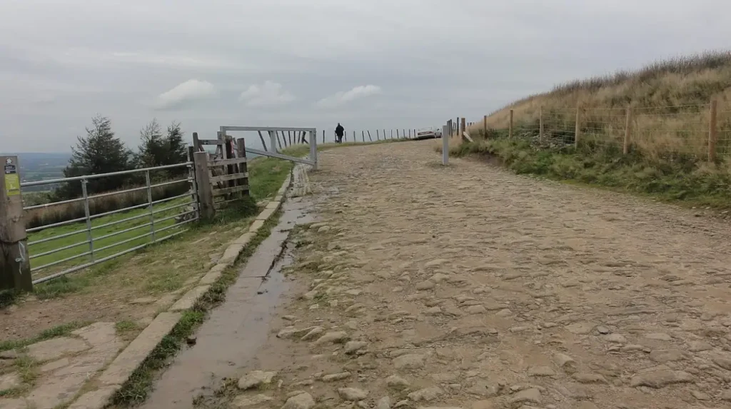
The highest point within the ceremonial county of Greater Manchester is Black Chew Head at 542 meters above sea level. Other notable peaks include Winter Hill at 456 meters and Hailstorm Hill at 477 meters elevation.
Black Chew Head sits on the eastern edge of Saddleworth Moor within the parish of Saddleworth, forming the highest geographic elevation in the county. Winter Hill, located in the West Pennine Moors above Bolton, reaches an altitude of 456 meters and serves as a major regional communications hub. Nearby Hailstorm Hill rises to 477 meters within the Rossendale boundary, anchoring the northern highland group. Holcombe Hill stands at 366 meters above Bury, prominent for its summit monument and panoramic views of the Manchester plain. Peel Tower sits atop Holcombe Hill as a regional landmark. Kinder Scout, located just across the Derbyshire border in the High Peak, reaches 636 meters and visually dominates the south-eastern horizon.
How did the Manchester Hills influence the Industrial Revolution?
The high rainfall, steep river valleys, and soft water of the Manchester Hills provided essential hydropower and process water for early textile mills. Rich deposits of coal and gritstone further fueled regional industrial expansion during the nineteenth century.
Water draining from the highland catchment areas fed fast-flowing rivers including the Irwell, Roch, Medlock, and Tame. Early industrial pioneers constructed cotton and wool spinning mills along these steep valley floors to harness water power via water wheels. The acidic, soft water flowing off gritstone gathering grounds proved ideal for textile bleaching, dyeing, and finishing industries. Local mining operations extracted coal from seams exposed along the hilly terrain to power steam engines as steam replaced water mills. Quarries carved into the hillside gritstone provided building materials for mill complexes, worker housing, canals, and railway viaducts. Reservoirs constructed across the highland valleys provided controlled water supplies for both manufacturing processes and expanding urban populations.
What wildlife and habitats exist in the Manchester Hills?
The Manchester Hills contain priority conservation habitats including upland blanket bog, heather moorland, acid grassland, and clough woodlands. These areas support rare bird species such as mountain hares, golden plovers, curlews, and short-eared owls.
Peatlands cover extensive upper areas of the plateau, storing large volumes of carbon and supporting specialized plant communities including sphagnum moss, cotton grass, and bilberry. The wet moorlands serve as critical breeding grounds for wading birds such as the Eurasian curlew, European golden plover, and common snipe. Birds of prey including merlins, short-eared owls, and kestrels hunt across open heathland areas. Lower valley slopes feature clough woodlands dominated by native sessile oak, silver birch, and rowan trees along steep river channels. Mammal populations include native mountain hares, red foxes, stoats, and various bat species roosting in rock crevices and disused quarries. Environmental restoration projects actively rewet degraded peat bogs to preserve these sensitive ecological communities.
What outdoor recreational activities are available in the Manchester Hills?
The Manchester Hills offer extensive opportunities for hiking, trail running, mountain biking, rock climbing, and fell walking. Long-distance footpaths such as the Pennine Way and the West Pennine Way traverse the region.

Public rights of way cross the entire upland landscape, granting access to public footpaths, bridleways, and designated open access land under the Countryside and Rights of Way Act 2000. Hikers frequency routes around Holcombe Moor, Rivington Pike, Blackstone Edge, and the Dovestone Reservoir complex. Mountain bikers utilize rugged bridleways and dedicated trail networks across the West Pennine Moors and South Pennine ridges. Gritstone escarpments such as Wimberry Rocks and Den Lane offer technical traditional climbing and bouldering routes. Reservoir loops provide accessible walking paths suitable for families and leisure walkers. Fell running events take place throughout the year, using steep terrain and moorland trails for competitive distance races across local summits.
How do you reach the Manchester Hills using public transport?
Rail services from central Manchester stations connect directly to gateway towns at the foot of the hills, including Bolton, Greenfield, Littleborough, and Glossop. Local bus networks connect these stations to trailheads.
Northern Trains operates regular direct rail services from Manchester Victoria and Manchester Piccadilly to key access points along the valley margins. Trains running along the Calder Valley Line stop at Rochdale, Smithy Bridge, and Littleborough, placing passengers near the South Pennines. The Huddersfield Line stops at Greenfield station in Saddleworth, allowing direct access to Dovestone Reservoir and the Dark Peak edge. Services toward Glossop bring walkers to the base of the High Peak plateau. TransPennine Express and local bus routes operated by Transport for Greater Manchester connect urban centers to rural villages like Rivington, Broadbottom, and Uppermill. These public transport corridors permit point-to-point hiking without requiring personal vehicular transport.
Frequently Asked Questions
What are the best hiking trails in the Manchester Hills?
Popular routes include the hike up Rivington Pike, the walk around Dovestone Reservoir up to the Chew Valley, and the trail across Blackstone Edge following the historic Roman road.
Are the Manchester Hills part of the Peak District?
The eastern and south-eastern sections of the Manchester Hills border or overlap with the Peak District National Park, while the northern sections belong to the West Pennine Moors and South Pennines.
How high are the hills surrounding Manchester?
Elevations range from around 150 meters on the lower slopes to 542 meters at Black Chew Head, with nearby Peak District summits exceeding 600 meters.
Can you see Manchester city center from the hills?
Yes, high points like Winter Hill, Holcombe Hill, and Hartshead Pike offer clear, unobstructed views of the Manchester city center skyline on clear days.
What is the best time of year to visit the Manchester Hills?
Late spring through autumn offers the best conditions for hiking, with blooming heather covering the moorlands in vibrant purple during late summer.