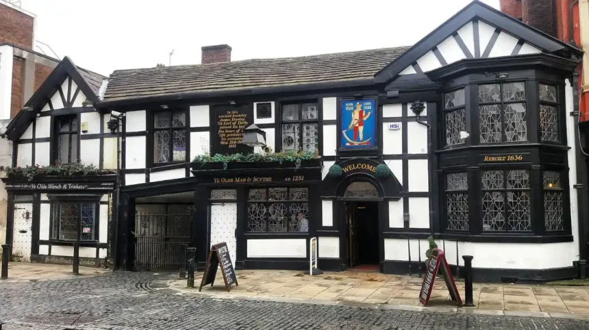
Hidden gems in Tameside represent the overlooked historic, natural, and cultural landmarks situated within the Metropolitan Borough of Tameside, Greater Manchester. These sites provide ecological diversity, architectural heritage, and industrial history outside of major urban tourist centers.
- What makes Park Bridge Heritage Centre a significant historical location?
- Why is Buckton Castle considered an important archaeological site?
- How does Fairfield Moravian Settlement preserve Georgian architecture?
- What natural features can visitors find at Eastwood Nature Reserve?
- What makes Portland Basin Museum a center for industrial heritage?
- How does Hartshead Pike serve as a historic landmark?
- Frequently Asked Questions
- What are the best hidden gems in Tameside for outdoor walking?
- Are the historic hidden spots in Tameside free to visit?
- How do I reach Tameside’s hidden gems using public transport?
- Why is Fairfield Moravian Settlement historically unique?
- What is the best time of year to explore hidden nature spots in Tameside?
The historical context of Tameside centers on its transformation during the Industrial Revolution. The region evolved from agrarian settlements into a manufacturing hub for cotton textiles, coal mining, and canal transport. The borough was formally established on April 1, 1974, under the Local Government Act 1972. It combined nine municipal districts: Ashton-under-Lyne, Audenshaw, Denton, Droylsden, Dukinfield, Hyde, Longdendale, Mossley, and Stalybridge. The physical structure of these hidden spots consists of preserved canal junctions, protected ancient woodlands, early Victorian parks, and historic architectural structures.
The operational processes governing these local spots involve conservation frameworks managed by local authorities, nature trusts, and community organizations. Environmental management preserves local flora and fauna, while structural maintenance safeguards listed buildings and ancient monuments. Real-world examples of these locations include Park Bridge Heritage Centre, Buckton Castle, Fairfield Moravian Settlement, Cheetham’s Park, and the Eastwood Nature Reserve.
According to local council records, Tameside covers approximately 40 square miles and contains over 300 listed buildings along with several SSSI (Site of Special Scientific Interest) zones. The ongoing preservation of these locations directly influences regional biodiversity, educational tourism, and community wellbeing across Greater Manchester.
What makes Park Bridge Heritage Centre a significant historical location?
Park Bridge Heritage Centre is a preserved ironworks village nestled in the Medlock Valley that offers a complete look into nineteenth-century industrial manufacturing, labor history, and regional iron production.
The village of Park Bridge was established in 1786 by Samuel Lees. The site expanded into an ironworks complex that produced components for global engineering projects, including roller iron for cotton mills and rivets for the Eiffel Tower. The structural layout of the location includes old factory foundations, historic stone cottages, a reconstructed waterwheel pit, and protected woodland trails within the Medlock Valley.
The mechanism behind its preservation relies on joint conservation efforts between Tameside Council and local heritage groups. Environmental succession has allowed nature to reclaim former industrial spaces, creating a blend of industrial ruins and broadleaf forest habitats. Visitors can walk along former railway lines and explore educational displays detailing iron forging techniques.
Research indicates that the Park Bridge ironworks operated continuously for over 170 years before closing in 1963. The site now serves as an ecological haven for birds and small mammals while offering historic educational resources. Preserving Park Bridge ensures that early industrial technology and working-class social conditions remain accessible for historical study.
Why is Buckton Castle considered an important archaeological site?
Buckton Castle is a medieval ringwork castle situated on Buckton Hill near Stalybridge, serving as one of the few verified medieval fortification sites in Greater Manchester.
The castle was constructed during the late twelfth century, likely by William de Neville or Ranulf de Blondeville, the 6th Earl of Chester. The structure was intentionally built on a high ridge 1,100 feet above sea level to command clear strategic views across the Tame Valley. The physical structure consists of a circular stone wall, an outer ditch, and a central courtyard measuring roughly 115 feet in diameter.
Archaeological processes at the site have involved systematic excavations led by the University of Manchester Archaeological Unit. Excavations have uncovered stone curtain walls, a stone-built gatehouse, and medieval iron artifacts. These findings confirm that the castle was used as a military stronghold before falling into ruin during the fourteenth century.
Historical data confirms that Buckton Castle is recognized as a Scheduled Ancient Monument. The site provides clear evidence of Norman and post-Norman military architecture in North West England. Studying Buckton Castle helps historians understand territorial control, feudal power structures, and medieval defense strategies across Cheshire and Lancashire.
How does Fairfield Moravian Settlement preserve Georgian architecture?
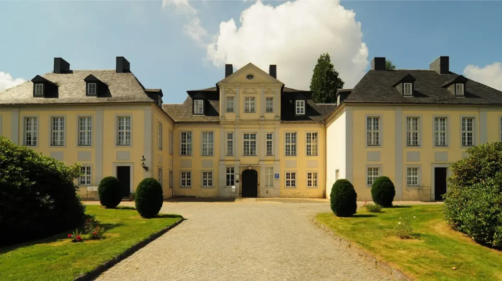
Fairfield Moravian Settlement is a planned religious community in Droylsden, designed in 1785 to provide a self-contained environment for members of the Moravian Church.
The Moravian Church established Fairfield under the direction of Benjamin La Trobe. The layout was planned as a model village featuring uniform Georgian red-brick buildings, wide cobbled streets, a central square, a chapel, and residential quarters. The structural design incorporated dedicated communal spaces, single brethren and sister houses, and workshop areas for specialized trades.
The preservation process operates under Grade II* listed building protections and conservation area regulations. The settlement maintains strict guidelines to preserve original architectural features, including sash windows, cobbled lanes, timber doorways, and central green spaces. The community still functions as an active residential area and place of worship.
Fairfield contains over 60 listed buildings within its compact geographic boundary. It stands as an intact example of eighteenth-century utopian urban planning in Great Britain. The settlement offers researchers insight into religious freedom, early social welfare models, and late Georgian residential design.
What natural features can visitors find at Eastwood Nature Reserve?
Eastwood Nature Reserve is a designated Site of Special Scientific Interest located adjacent to Cheetham’s Park in Stalybridge, featuring ancient woodland, lowland raised bog, and varied wildlife habitats.
The reserve was acquired by the RSPB in 1931 as one of its earliest land acquisitions, before management was transferred to the Cheshire Wildlife Trust. The physical landscape consists of 11.6 acres of lowland raised mire surrounded by mixed deciduous trees, birch woodlands, and natural mosslands.
Ecological management processes inside the reserve focus on wetland restoration and habitat protection. Water levels are maintained to support sphagnum mosses, cotton grass, and cross-leaved heath. Controlled access paths prevent soil compaction, allowing native plant species and breeding bird populations to thrive without human disruption.
Biological surveys have identified numerous bird species at Eastwood, including spotted flycatchers, tawny owls, and various woodpecker species. The site contains rare peat bog ecosystems that store atmospheric carbon. Preserving Eastwood Nature Reserve protects region-specific biodiversity and provides valuable environmental research opportunities in urban fringe settings.
What makes Portland Basin Museum a center for industrial heritage?
Portland Basin Museum is a heritage museum located in Ashton-under-Lyne, housed within a restored 1834 canal warehouse at the junction of three historic canals.
The canal warehouse was built by the Ashton Canal Company to handle goods transfers between the Ashton Canal, Peak Forest Canal, and Huddersfield Narrow Canal. The building features a timber-framed internal structure, stone walls, and an internal canal arm that allowed barges to unload directly inside the facility.
The museum’s operations center on preserving and displaying artifacts from Tameside’s industrial past. Key exhibits include a reconstructed 1920s street scene with a working chapel, pawn shop, and traditional kitchen. Interactive displays show coal mining machinery, textile looms, and canal transport technologies that drove economic growth during the Industrial Revolution.
Visitor statistics show that Portland Basin Museum hosts tens of thousands of school children and tourists annually. The facility holds extensive archival collections documenting local labor history, textile manufacturing, and inland waterway trade. The museum protects regional social history while teaching future generations about early industrial engineering.
How does Hartshead Pike serve as a historic landmark?
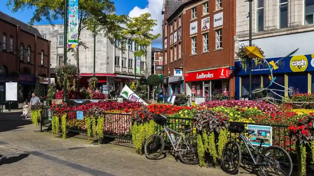
Hartshead Pike is a prominent hill tower situated on Hartshead Hill in Ashton-under-Lyne, offering panoramic views across Greater Manchester, Cheshire, and Lancashire.
The current tower was constructed in 1863 by architect John Eaton to replace an earlier eighteenth-century stone beacon tower that had collapsed. Local records indicate that lighting beacons existed on the hill as early as the sixteenth century to signal national emergencies and celebrations. The structure stands 59 feet high, built from local gritstone with a conical roof and gothic architectural detailing.
The landmark is preserved through public maintenance programs overseen by local heritage groups and local government authorities. The surrounding trails are maintained for public access, allowing walkers to reach the summit from Ashton-under-Lyne and Mossley. Reinvestment projects focus on structural repair, masonry restoration, and clear pathway signposting.
The tower stands at an altitude of 267 meters above sea level, making it visible from miles away across the Pennine foothills. It serves as a visual navigation marker and historic monument honoring regional civic pride. Preserving Hartshead Pike guarantees that historical commemoration and open public green spaces remain accessible to local residents.
Frequently Asked Questions
What are the best hidden gems in Tameside for outdoor walking?
The best hidden spots for walking include Park Bridge Heritage Centre, Eastwood Nature Reserve, and the trails around Hartshead Pike. These locations offer peaceful woodland paths, historic canal routes, and elevated hill climbs with clear regional views.
Are the historic hidden spots in Tameside free to visit?
Most historical and natural hidden spots in Tameside, such as Fairfield Moravian Settlement and Portland Basin Museum, offer free admission. Some locations may charge small fees for special events, parking, or specific guided heritage tours.
How do I reach Tameside’s hidden gems using public transport?
Tameside is well connected by northern rail services, the Manchester Metrolink network, and local bus routes serving Ashton-under-Lyne, Hyde, and Stalybridge. Canal towpaths also provide traffic-free walking and cycling links between major sites like Portland Basin.
Why is Fairfield Moravian Settlement historically unique?
Fairfield Moravian Settlement is unique because it was built in 1785 as a completely planned Georgian model village. It retains over 60 Grade II* listed buildings, preserving original architectural designs and cobbled streets.
What is the best time of year to explore hidden nature spots in Tameside?
Late spring through early autumn is ideal for visiting nature spots like Eastwood Reserve and Cheetham’s Park. During these months, trails are dryer, wild flora is in full bloom, and wildlife activity is at its highest.