The Manchester M11 postcode district covers a major section of East Manchester within the Greater Manchester urban area. It serves as a vital postal division established by Royal Mail for sorting and routing mail efficiently across the region. The area encompasses key urban neighborhoods including Beswick, Clayton, Miles Platting, and West Gorton. Geographically, it sits directly east of Manchester City Centre, positioned within the jurisdiction of Manchester City Council. This sector has evolved from a heavy manufacturing zone into a central hub for sports infrastructure, residential developments, and commercial growth. The code prefix M signifies its placement within the broader Manchester post town boundary.
- What Areas Are Covered by the Manchester M11 Postcode District?
- How Has Regeneration Transformed the Physical Environment of M11?
- What Transport Links Connect M11 to Greater Manchester?
- What Role Does Sport and Recreation Play in the M11 Economy?
- What Are the Demographic and Housing Trends Across the M11 District?
- Frequently Asked Questions
Historically, the M11 territory functioned as an industrial powerhouse during the nineteenth and twentieth centuries. Factories, chemical works, and textile mills dominated the landscape alongside dense rows of worker housing. The decline of traditional manufacturing during the mid-twentieth century left large tracts of land disused and economically depressed. A major turning point occurred in the late 1990s when Manchester won the bid to host the 2002 Commonwealth Games. This event triggered comprehensive urban renewal programs led by public and private partnerships. Tens of millions of pounds were directed toward land remediation, public infrastructure, and modern sporting venues, permanently changing the physical layout of the postal code.
What Areas Are Covered by the Manchester M11 Postcode District?
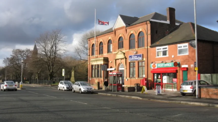
The Manchester M11 postcode district covers four primary urban neighborhoods located east of the city center: Beswick, Clayton, Miles Platting, and West Gorton. These communities sit inside the M11 boundary, bordered by the M12 district to the south and the M4 and M40 districts to the north and west. Beswick forms the central core of recent sports-led developments, housing major stadium complexes and training centers. Clayton extends eastward toward Droylsden, maintaining a mix of traditional red-brick terraced housing and modern apartment blocks. Miles Platting occupies the northern segment, featuring extensive canal-side regeneration along the Rochdale Canal, while West Gorton anchors the southern boundary with newly built family homes and public parkland.
The physical spatial structure of M11 relies on major arterial roads that connect East Manchester directly to central business districts. Ashton New Road and Ashton Old Road act as the primary east-west corridors running straight through the postcode. The corridor contains a mix of municipal buildings, health facilities, primary schools, and neighborhood retail units. Royal Mail routes all physical logistics for this district through the main Manchester mail centre before localized delivery takes place. Boundaries are strictly managed to support electoral ward alignment and postal routing efficiency. The geographic expanse balances dense residential housing layouts with wide open spaces reserved for international sporting venues and modern industrial estates.
How Has Regeneration Transformed the Physical Environment of M11?
Arne Müseler
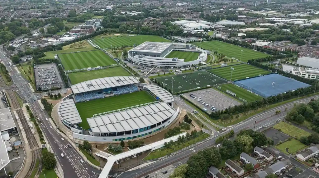
Regeneration transformed the physical environment of M11 through structured land remediation, public funding, and private sector investments over three decades. Industrial land that once housed coal pits and ironworks underwent extensive decontamination to prepare for modern structural projects. The establishment of the Etihad Campus on former industrial land in Beswick created an international sports precinct. Over 200 acres of derelict land were converted into training pitches, stadium expansions, and research facilities. Public investment from Manchester City Council combined with private equity from the Abu Dhabi United Group accelerated construction. Modern civil engineering introduced new drainage systems, energy grid upgrades, and high-density residential layouts throughout the district.
Residential regeneration initiatives led by housing providers transformed neighborhood architecture across Miles Platting and West Gorton. Old, substandard housing blocks were systematically replaced with energy-efficient housing developments built to modern environmental standards. Public park developments, such as the Medical Quarter green space and West Gorton Community Park, introduced sustainable drainage systems designed to handle climate resilience. These physical upgrades reduced local flood risks while providing structured green areas for residents. Transport linkages were integrated into street planning, replacing disused industrial rail lines with electrified light rail tracks. The physical change converted an eroded industrial sector into a modern suburban neighborhood close to the commercial core.
What Transport Links Connect M11 to Greater Manchester?
The Manchester M11 postcode connects to Greater Manchester through a multi-modal transport network consisting of light rail, bus corridors, and road infrastructure. The Metrolink tram network operates through the heart of M11 via the Ashton-under-Lyne line, offering rapid transit stops at Etihad Campus, Velopark, and Clayton Hall. Trams run every 12 minutes during standard service hours, allowing commuters to reach Manchester Piccadilly station in under ten minutes. Key road networks include the A662 Ashton New Road and the A635 Ashton Old Road, providing direct vehicular routes toward the M60 orbital motorway. Public bus operators run frequent daily services along these primary road channels, providing public transit coverage across all sub-districts.
Pedestrian and cycle transport infrastructure within M11 has seen major upgrades through the Bee Network initiative funded by Transport for Greater Manchester. Dedicated cycle tracks follow the Rochdale Canal and the Ashton Canal, offering traffic-free routes into the city center and toward adjacent local towns. Rail freight infrastructure surrounding former industrial yards has been repurposed, though passenger rail reliance in M11 is handled primarily through nearby stations like Ashburys. The transport matrix supports heavy commuting patterns, especially on match days and event nights when venue attendance rises by tens of thousands. Transport routing models ensure the postcode remains integrated into the wider commercial economy of Greater Manchester.
What Role Does Sport and Recreation Play in the M11 Economy?
Sport and recreation drive the economic engine of the M11 postal code by attracting global investments, event tourism, and specialized service industries. The Etihad Stadium, home to Manchester City Football Club, forms the central anchor of this sports economy, attracting over 50,000 visitors per home fixture. Adjacent to the stadium sits the National Cycling Centre, featuring an indoor velodrome and international BMX arena that hosts national training programs. The Co-op Live arena, an indoor entertainment venue with a 23,500 capacity, expanded the local event ecosystem upon its opening. These facilities generate substantial local expenditure in hospitality, security operations, facilities management, and event logistics.
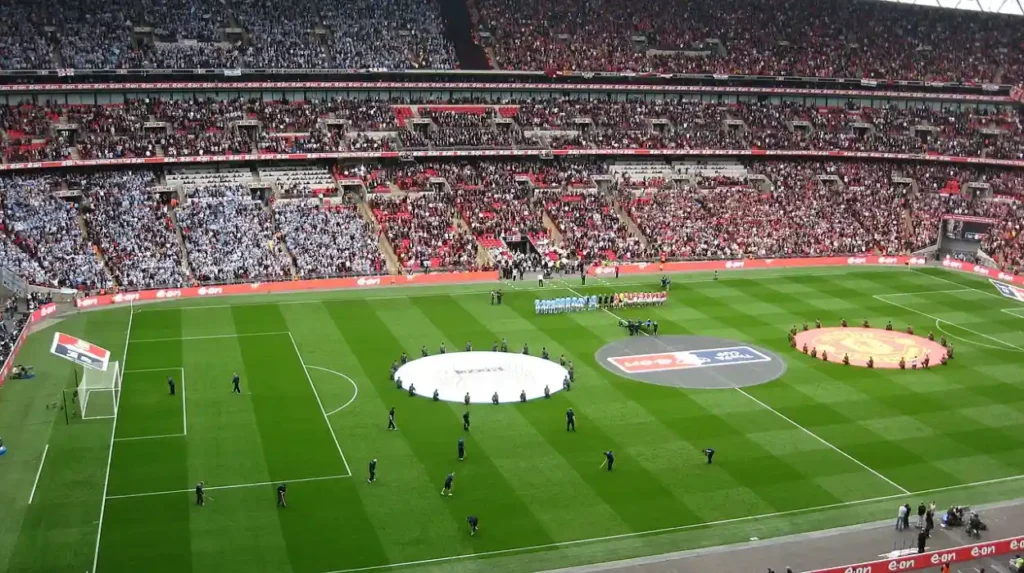
The concentration of national sports institutions within M11 creates direct employment opportunities for local residents across facility operations, catering, and sports science support. Sport England and UK Sport continue to channel facility development grants into the district to support elite athlete training programs. Community access agreements ensure that local schools and recreational clubs use the high-performance training grounds outside of professional usage windows. Surrounding commercial areas have adapted by opening food retail outlets, short-term accommodation units, and transport hubs optimized for venue crowds. The recreational sector has successfully shifted the local economic foundation from heavy manufacturing to international sports services and entertainment management.
What Are the Demographic and Housing Trends Across the M11 District?
Demographic and housing trends across M11 show a growing population driven by urban expansion and affordable housing development compared to the central city core. The district historically contained a predominantly working-class demographic, but recent residential developments have attracted young professionals, students, and family units. Data from the Office for National Statistics indicates steady population growth across the Beswick and Clayton wards over the past decade. Housing stock within M11 consists of a mix of classic two-up two-down Victorian terraces, modern housing developments, and multi-story apartment complexes. Property values have experienced steady capital appreciation as demand for housing within two miles of Manchester City Centre rises.
Tenure options across M11 are balanced between private owner-occupation, social housing schemes, and private rented sector properties. Registered social landlords manage large housing estates in Miles Platting and West Gorton under long-term regeneration partnerships. Rent prices remain lower than in the neighboring M1, M3, and M4 postcodes, making M11 an attractive option for first-time home buyers and working families. Modern construction projects focus on high energy efficiency ratings, incorporating heat pumps and solar technology into new building footprints. The combination of affordable housing stock, proximity to public transit, and major employment zones maintains high occupancy rates and low rental void periods throughout the neighborhood.
Related Area Guides:
- Want to explore central city postcodes? Read our detailed breakdown onimportant Manchester M1 address locations.
- Interested in civic identity? Discover the completehistory and origin of the Manchester bee emblem.
- Planning a trip north? Learn how to navigatetravel options across Lancashire and Greater Manchester.
Frequently Asked Questions
What areas fall under the Manchester M11 postcode?
The Manchester M11 postcode covers the eastern neighborhoods of Beswick, Clayton, Miles Platting, and West Gorton. It sits within the local government authority of Manchester City Council.
How far is the M11 postcode from Manchester City Centre?
The M11 postcode district is located approximately 1.5 to 3 miles east of Manchester City Centre. Travel time via the Metrolink light rail takes under ten minutes to Piccadilly.
What is the primary football stadium located in the M11 district?
The Etihad Stadium, home to Manchester City Football Club, is located directly within the M11 postcode district in Beswick. It forms part of the larger Sportcity and Etihad Campus grounds.
Are there good public transport connections in M11?
Yes, M11 features Metrolink tram stops including Etihad Campus and Velopark, alongside regular bus routes on Ashton New Road and Ashton Old Road.
What type of housing is available in the M11 area?
Housing in M11 includes traditional red-brick Victorian terraces, modern social housing developments, and contemporary apartment developments built during recent regeneration projects.