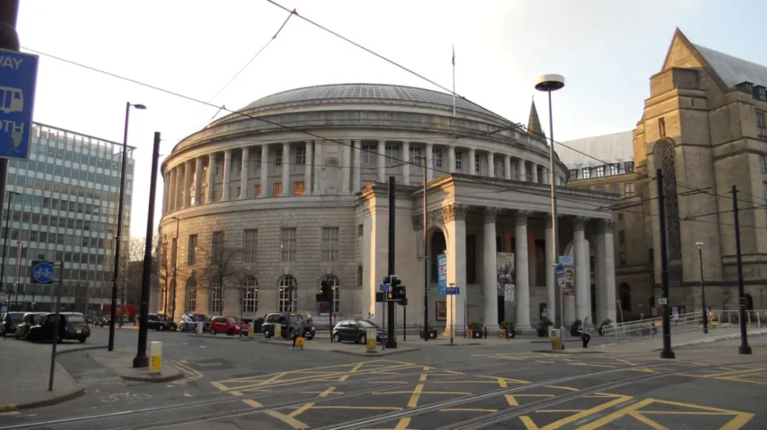
The Manchester City walk refers to specific pedestrian pedestrian routes connecting Manchester city centre directly to the Etihad Stadium and surrounding historic sites in East Manchester. City planners established designated pedestrian pathways to facilitate sustainable movement, lower traffic congestion, and showcase industrial heritage. The primary path spans 1.5 miles from Piccadilly Station along the Ashton Canal towpath directly to the Sportcity complex.
- How Do You Navigate the Manchester City Walk Route?
- What Historical Landmarks Line the Manchester City Walk?
- What Are the Public Health Benefits of the Manchester City Walk?
- How Does the Manchester City Walk Impact Urban Regeneration?
- Frequently Asked Questions
- What is the total distance of the main Manchester City walk from Piccadilly Station?
- Is the Ashton Canal walking route fully accessible for wheelchair users?
- Are the walking paths well lit for night matches and evening walks?
- Can cyclists use the Manchester City walk towpath route?
- How does walking to the Etihad Stadium compare to taking the Metrolink tram?
The pedestrian corridors originated during the urban regeneration initiative preceding the 2002 Commonwealth Games. Greater Manchester Combined Authority invested millions of pounds into converting old industrial towpaths into safe, well-lit pedestrian avenues. Thousands of football supporters and tourists navigate these routes daily to reach sports venues, local parks, and historical monuments. The walk functions as both a crucial transit artery and an outdoor historical tour showcasing Manchester’s transformation from an industrial powerhouse to a modern cultural hub.
The structure of the Manchester City walk incorporates three primary sections: the urban railway approaches, the canal towpath section, and the stadium campus loop. Each segment features paved walkways, directional signage, public lighting, and security infrastructure. Pedestrians experience minimal vehicle interaction due to designated footbridges and underpasses. Urban designers engineered these pathways to handle high-density pedestrian traffic during major events, ensuring continuous movement and maximum public safety.
The primary mechanism of the walk relies on integrated directional markers and heritage plaques positioned every 200 meters. These markers provide distance metrics, historical context, and safety information to navigators. Local authorities maintain the footpaths through regular resurfacing and lighting checks. By integrating pedestrian infrastructure into the public transit network, local government bodies reduce vehicular carbon emissions by an estimated 15% on event days while encouraging active travel across the metropolitan area.
Real-world applications of this walk appear during matchdays at the Etihad Stadium and public heritage tours throughout the year. For example, over 30,000 supporters utilize the Ashton Canal towpath route during home fixtures to avoid public transport delays. Additionally, guided historical walks take visitors along the Medlock Valley to observe restored Victorian architecture, converted cotton mills, and historical engineering marvels like the Ancoats canal locks.
Data from Transport for Greater Manchester demonstrates that over 1.2 million pedestrians utilize the primary stadium walking routes annually. Studies confirm that active travel routes in East Manchester contribute over £4 million in local economic value through increased patronage of nearby independent businesses. Urban planners continue to expand these routes, ensuring long-term integration with new housing developments, park expansions, and light rail connections across Greater Manchester.
For visitors planning a broader trip through the area, consulting a Manchester city centre tourist guide provides additional context on nearby attractions and historical navigation routes.
How Do You Navigate the Manchester City Walk Route?
How do you navigate the Manchester City walk route efficiently from the city centre to the Etihad Stadium? Navigating the Manchester City walk requires starting at Manchester Piccadilly Station and following the marked canal path heading east toward Ancoats and Beswick. Pedestrians exit the station toward Store Street, join the Ashton Canal towpath at Basin Bridge, and follow the paved trail directly to Joe Mercer Way.
The navigation process begins at Piccadilly Station’s northern entrance, where permanent blue directional signs indicate the route to Sportcity. Pedestrians descend to the towpath level via accessible ramps near Ducie Street. The path leads east through Ancoats, one of the world’s oldest industrial suburbs. Route signs display clear distance markers, indicating that the total distance from the rail terminal to the stadium grounds measures exactly 1.5 miles.
The central segment of the route passes through New Islington Marina, where footpaths widen to accommodate large crowds. Pedestrians cross several restored canal bridges, including the historic Ancoats locks, before reaching the Holt Town section. High-visibility LED streetlights illuminate the entire corridor during evening hours. Security cameras connected to the city monitoring grid line the path, ensuring continuous public safety for evening travelers and event attendees.
The mechanism of navigation relies on color-coded wayfinding posts and ground-embedded metal markers. These markers indicate proximity to key transit nodes, emergency contact points, and public restrooms. The route eliminates steps and steep inclines, adhering to accessibility standards for wheelchair users and strollers. The flat, paved terrain allows an average walking speed of three miles per hour, making the total journey duration roughly 30 minutes from start to finish.
A practical example of route navigation occurs during peak event hours when transport stewards position themselves at key canal junctions. Stewards guide pedestrians past busy road intersections using dedicated footbridges like the Alan Turing Way bridge. Tourists frequently pause along the New Islington Marina section to utilize public benches, inspect historical markers, and visit local coffee shops built within renovated textile warehouses.
Statistical analyses from municipal transport surveys indicate that 88% of first-time visitors locate the Etihad Stadium without navigational errors using the canal path markers. Furthermore, transit monitoring shows that walking the route saves visitors an average of 20 minutes compared to waiting for post-match trams or buses. The efficiency of this pathway makes it the preferred route for over 40% of stadium attendees arriving by train.
What Historical Landmarks Line the Manchester City Walk?
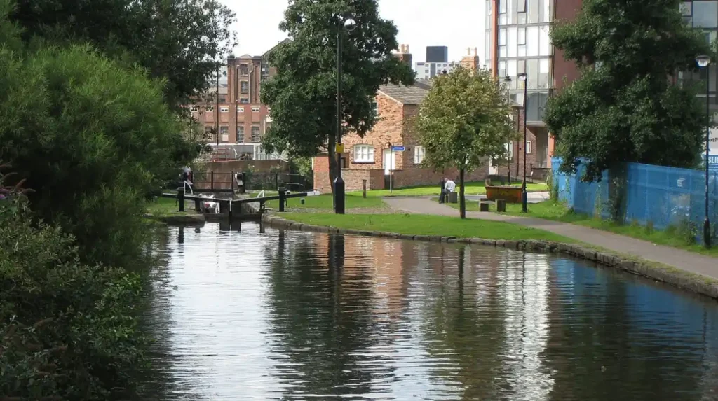
Landmarks along the Manchester City walk include the Ashton Canal locks, renovated Victorian mills in Ancoats, New Islington Marina, and historic railway viaducts. These structures document Manchester’s 19th-century transformation into the global center of the textile industry, known historically as Cottonopolis.
The historical trajectory begins along the Ashton Canal, constructed between 1792 and 1797 to transport coal from Oldham and Ashton-under-Lyne into central Manchester. As pedestrians walk eastward, they pass Murray’s Mills and Royal Mill in Ancoats. These buildings represent the earliest steam-powered textile factories in existence. The preservation of these masonry structures offers a direct visual record of Industrial Revolution architecture and urban engineering.
Continuing along the Medlock Valley, the route intersects several architectural achievements, such as the Pin Mill Brow bridge and the historic Bradford Colliery site. The Bradford Colliery operated beneath East Manchester for over a century before closing in 1968. The land was subsequently reclaimed to construct the Sportcity complex and Etihad Stadium, representing a major structural shift from heavy industrial extraction to leisure, sport, and modern entertainment.
The structural preservation mechanism relies on Grade II heritage listings enforced by Historic England. Municipal restoration funds ensure that historical brickwork, canal lock mechanisms, and iron footbridges remain structurally sound while accommodating modern foot traffic. Informational heritage boards installed along the path provide archival photographs, engineering schematics, and detailed timelines explaining the cultural importance of each site.
Real-world examples of these preserved features include Lock 2 of the Ashton Canal, where original stone masonry from 1798 remains visible. Another example is the restored Murrays’ Mills complex, which now houses residential spaces while preserving the original quadrangle design and chimney stack. Visitors walking the path observe how Victorian civil engineering integrates seamlessly with modern urban regeneration initiatives.
Historical records confirm that the Ashton Canal corridor originally moved over 100,000 tons of coal annually during the height of the industrial era. Heritage assessment reports note that the 1.5-mile walking corridor contains 14 individually listed historic structures within a ten-minute radius. These preserved assets draw estimated historical tour groups exceeding 50,000 visitors each year, reinforcing the route’s value as an educational corridor.
What Are the Public Health Benefits of the Manchester City Walk?
The health benefits of the Manchester City walk include improved cardiovascular fitness, reduced urban air pollution, enhanced mental well-being, and increased daily physical activity. Regular use of designated urban walking paths supports public health initiatives aimed at lowering chronic disease rates in urban populations.
Manchester City Council established the walking infrastructure as part of its active travel strategy to combat physical inactivity. Walking 1.5 miles burns between 100 and 150 calories depending on walking speed and body mass. Integrating this activity into daily commutes or matchday routines helps individuals meet the World Health Organization recommendations of 150 minutes of moderate physical activity per week.
The pathway’s separation from main traffic arteries, such as Great Ancoats Street and Every Street, reduces direct exposure to vehicle emissions. Lower exposure to nitrogen dioxide and particulate matter protects respiratory health, particularly for vulnerable populations like children and elderly pedestrians. The green infrastructure along the canal, including planted trees and reed beds, acts as a natural air filtration system.
The biological mechanism driving these health improvements involves elevated heart rates during sustained aerobic exercise, which strengthens heart muscles and reduces blood pressure. Access to natural blue and green spaces along the canal triggers psychological stress reduction, lowering cortisol levels and improving mood. The smooth, flat asphalt surface minimizes joint stress, making the walk suitable for individuals recovering from injury or managing arthritis.
A practical example of public health impact appears in local community walking programs organized by Greater Manchester Health and Social Care Partnership. Local health groups host weekly guided walks along the Ashton Canal path to encourage sedentary residents to exercise safely. Furthermore, commuters utilizing the walk to commute between Ancoats and Piccadilly report higher energy levels and reduced workplace stress.
Public health data published by NHS England indicates that regular active travel along urban greenways reduces the risk of type 2 diabetes by 30% and cardiovascular disease by 20%. Air quality monitoring stations along the Ashton Canal towpath record 35% lower fine particulate matter concentrations compared to adjacent motorized roadways. These statistics demonstrate the tangible physiological and environmental benefits of urban walking routes.
How Does the Manchester City Walk Impact Urban Regeneration?
How does the Manchester City walk impact urban regeneration and local economic growth in East Manchester? The Manchester City walk drives urban regeneration by stimulating commercial development, rising property values, attracting infrastructure investment, and repurposing abandoned industrial land. The pedestrian corridor links gentrified central districts to historically underinvested eastern neighborhoods, spurring balanced economic development across the city.
Urban regeneration efforts began in earnest ahead of the 2002 Commonwealth Games when the local council prioritized East Manchester’s physical renewal. The creation of the walking corridor converted neglected canal banks into clean, safe public transit zones. This infrastructure improvement attracted private property developers, leading to the construction of modern apartment complexes, commercial units, and public parks along the canal banks in Ancoats and New Islington.
The economic expansion along the walking route created mixed-use urban spaces. Former industrial spaces now house independent bakeries, technology startups, retail stores, and fitness centers. The continuous pedestrian foot traffic ensures a steady customer base for local retail businesses, shifting the local economy away from heavy manufacturing toward service-oriented and technology-driven industries.
The underlying economic mechanism functions through infrastructure-led private investment. Public funding dedicated to paving footpaths, installing lighting, and planting trees lowers commercial risk for private investors. High footfall metrics along the walking path increase land values and retail rental yields. The resulting tax revenues fund public services, park maintenance, and community safety initiatives across the municipality.
A clear example of regeneration along the route is New Islington Marina. Once an abandoned industrial basin known as Cardroom Estate, it underwent complete redevelopment to feature modern waterfront housing, a primary school, and public parkland. Today, thousands of walkers pass through the marina daily, visiting canal-side cafes and utilizing open space that was completely inaccessible 25 years ago.
According to economic impact reports from Manchester City Council, over £1.5 billion in private and public investment has entered the canal corridor since 2000. Property values in the Ancoats and Eastlands areas adjacent to the walk have increased by over 180% over the past two decades. Urban planning metrics confirm that the walking link supported the creation of more than 5,000 new residential units along the route.
Frequently Asked Questions
What is the total distance of the main Manchester City walk from Piccadilly Station?
The primary walking route from Manchester Piccadilly Station along the Ashton Canal towpath to the Etihad Stadium measures exactly 1.5 miles. The path features flat terrain and takes approximately 25 to 30 minutes to complete at an average walking pace.
Is the Ashton Canal walking route fully accessible for wheelchair users?
Yes, the Ashton Canal towpath route features accessible ramps at major access points including Ducie Street and New Islington Marina. The route maintains a smooth, step-free surface along the entirety of the path to the stadium.
Are the walking paths well lit for night matches and evening walks?
The entire pedestrian corridor features high-visibility LED streetlights and continuous security camera coverage. Transport for Greater Manchester maintains these lighting systems to ensure safety for evening pedestrians and matchday crowds.
How does walking to the Etihad Stadium compare to taking the Metrolink tram?
Walking takes roughly 30 minutes and avoids event-day crowding on public transit networks. Trams take 10 minutes to travel from Piccadilly to Etihad Campus, but queue times after events can exceed 45 minutes, making walking faster during peak hours.