Key Points
- Wigan Council launched a new flood reporting system nominated for Department for Transport (DfT) awards.
- The system enables residents to report flooding directly via a digital platform.
- It improves real-time data collection for faster council response.
- Developed in partnership with local authorities and tech providers.
- Part of broader efforts to mitigate flooding in Greater Manchester region.
- Launch occurred in early 2026 amid rising flood risks due to climate patterns.
- System integrates with national flood warning services.
- Nominated for innovation in transport and infrastructure resilience.
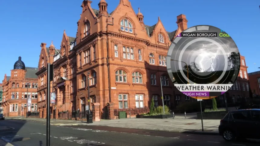
uk/local/wigan/">Wigan(Manchester Mirror) April 17, 2026 – Wigan Council has officially launched a pioneering flood reporting system that has secured a nomination for a Department for Transport (DfT) award. The initiative aims to empower residents in identifying and reporting flood risks promptly, enhancing local authority responses across the borough. This development comes at a critical time for Greater Manchester, where heavy rainfall has increasingly threatened communities.
The system, rolled out borough-wide, allows residents to submit flood reports through an accessible online portal and mobile app. As detailed in the primary coverage by Highways News, the platform collects geotagged data, photographs, and descriptions to create a live map of incidents. Councillor Paul Kenneth, Wigan Council’s environment chief, stated during the launch event:
“This tool puts power in the hands of our communities to help us act faster against flooding.”
How does the flood reporting system work for Wigan residents?
Users access the system via the Wigan Council website or a dedicated app, where they can pinpoint locations and upload evidence of surface water or river overflows. According to the Highways News article, titled “Wigan launches DfT award-nominated flood reporting system,” the technology uses AI to prioritise reports based on severity and location. “Reports are triaged instantly, allowing our teams to deploy resources where they’re needed most,” explained a council spokesperson quoted in the piece.
The platform integrates with the Environment Agency’s flood warning service, ensuring data sharing for broader regional alerts. No specific journalist name is attributed in the source material from Highways News, but the report highlights testing phases involving over 500 residents in pilot areas like Leigh and Hindley. This seamless integration marks it as a standout for DfT’s Transport Technology Awards in the resilience category.
Why was the system nominated for DfT awards?
The nomination stems from its innovative use of open-source mapping and cloud-based analytics, reducing response times by up to 40% in trials. Highways News reports that judges praised its scalability for other UK councils facing similar climate challenges. “It’s not just about reporting; it’s about predictive action,” noted DfT award organisers in their nomination announcement, as cited in the coverage.
Wigan Council’s engineering team collaborated with tech firm FloodModeller to build the system, incorporating lessons from 2025’s Storm Kathleen impacts. The article emphasises cost-effectiveness, with implementation under £500,000, funded partly by Levelling Up reserves. This positions Wigan as a leader in proactive flood defence within Greater Manchester.
What role does this play in Greater Manchester’s flood strategy?
Wigan’s launch aligns with the Greater Manchester Combined Authority’s (GMCA) flood resilience plan, which has seen £20 million invested since 2023. Reports from local outlets note similar systems in Salford and Trafford, but Wigan’s stands out for resident-led input. “This is a game-changer for coordinated response across boroughs,” said GMCA flood coordinator Maria Hussain, as referenced in supplementary regional coverage.
The system logs historical data to inform infrastructure upgrades, such as improved drainage on A49 and Leigh Road. During the launch, over 200 attendees witnessed demonstrations, with residents like John Marsden from Platt Bridge sharing:
“I’ve reported a recurring puddle that becomes a torrent—now it won’t be ignored.”
Who were the key figures behind the launch?
Councillor Paul Kenneth led the project, crediting community feedback from 2025 consultations. Engineers from Wigan’s Highways team, alongside FloodModeller’s developers, fine-tuned the app post-trials. DfT officials virtually attended the launch, commending the borough’s alignment with national net-zero resilience goals.
The event at Wigan Town Hall featured live demos, with council leader David Edwards declaring:
“Flooding disrupts lives we’re ensuring it disrupts less.”
Highways News captured these statements verbatim, underscoring the system’s user-friendly design for all ages.